Course Information
From the Cycle 2 Max Site:
A few stats for that all important gear choice.
The Baw Baw climb is 6km from the gatehouse to the summit with an elevation gain of 680m. This means that the average gradient is 11.3% for the whole climb (680/6000 x 100).
As a comparison, L’Alpe d’Huez, the most famous climb in the Tour de France is 13.8km at 7.9%. The Col du Tourmalet is 18.3km at 7.7% and the Col de la Madelaine is 19.4km at 7.7%.
The 2009 Tour of Spain had a climb up L’Angliru which was billed as the toughest climb in the world. It is 13km at an average of 9.6% with the last 6 km averaging 13%.
The steepest section is 23.5%. Although a “hors category” climb normally has an elevation gain of at least 1000m and more likely, 1500m, the steepness of Baw Baw would mean that it would be classed as a hors category in Europe.
So, based on that, Baw Baw is not that far behind L’Angliru. Toll ~ Neulynes = 2kms / Neulynes ~ Chair Gully = 2kms / Chair Gully ~ Finish = 3kms.
The webmaster does not recommend a 39×23 gearing as that makes the climb slow and painful. A compact crankset with at least a 25 on the back should ease the leg pain.
Many elite level riders have won this grueling race. See the past winners page for details and career highlights.
Map
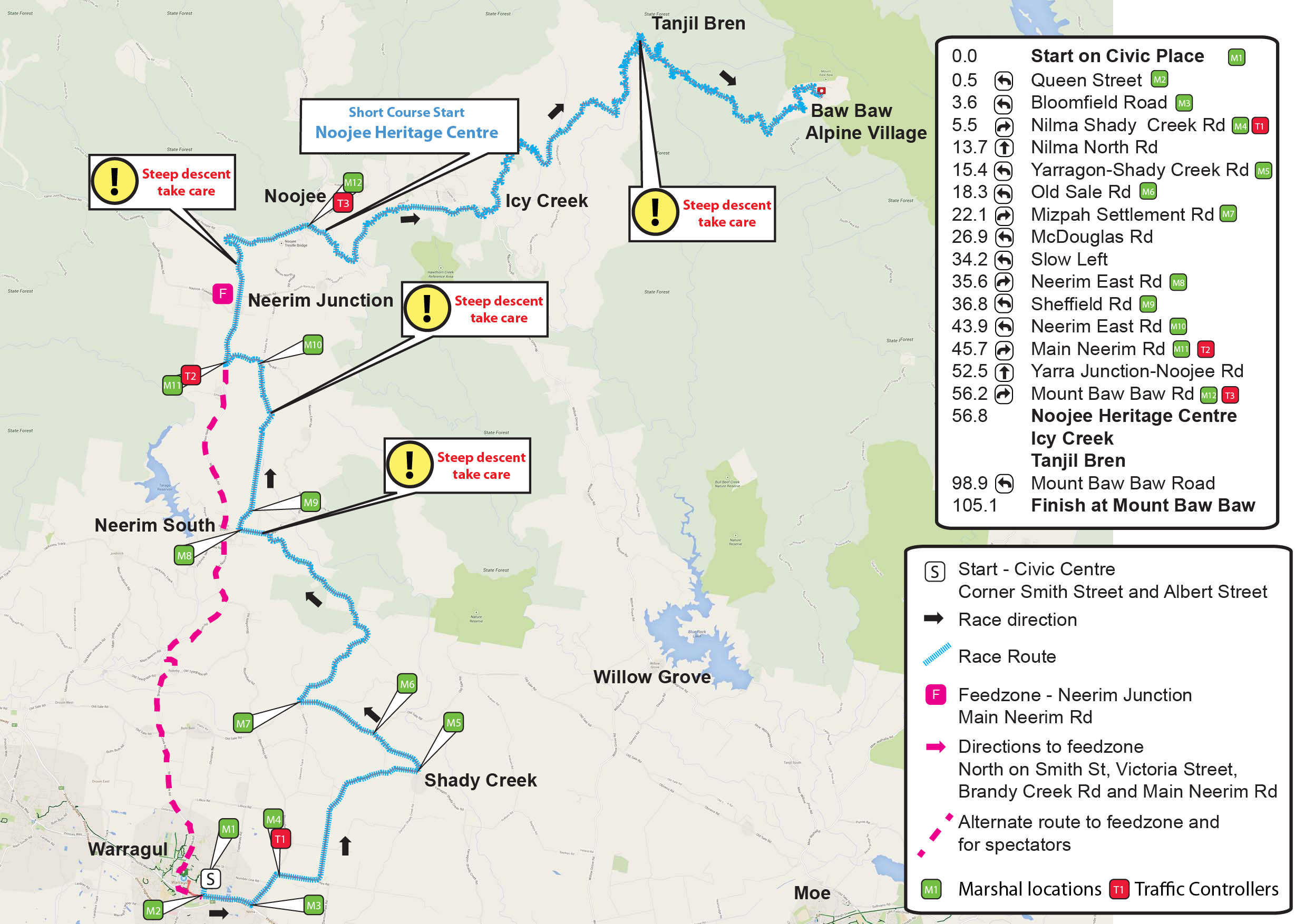
Baw Baw Classic 2023 Route
See the following page for start times.
See event info for details about return transport.
Altitude Profile
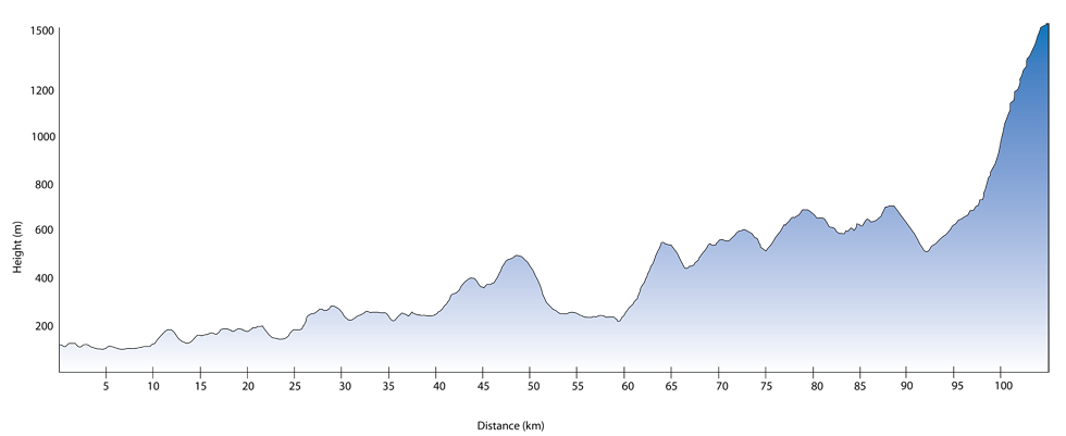
Baw Baw Classic Altitude Profile
Feed area – Neerim Junction
Spectator Vantage points – Feed station, Icy Creek, Tanjil Bren, Baw Baw Village. Note that cars behind the race will find it very difficult to pass so we suggest you go directly to the village and grab a coffee at the cafe before watching the finish.
Medal Presentations – Mt Baw Baw Village
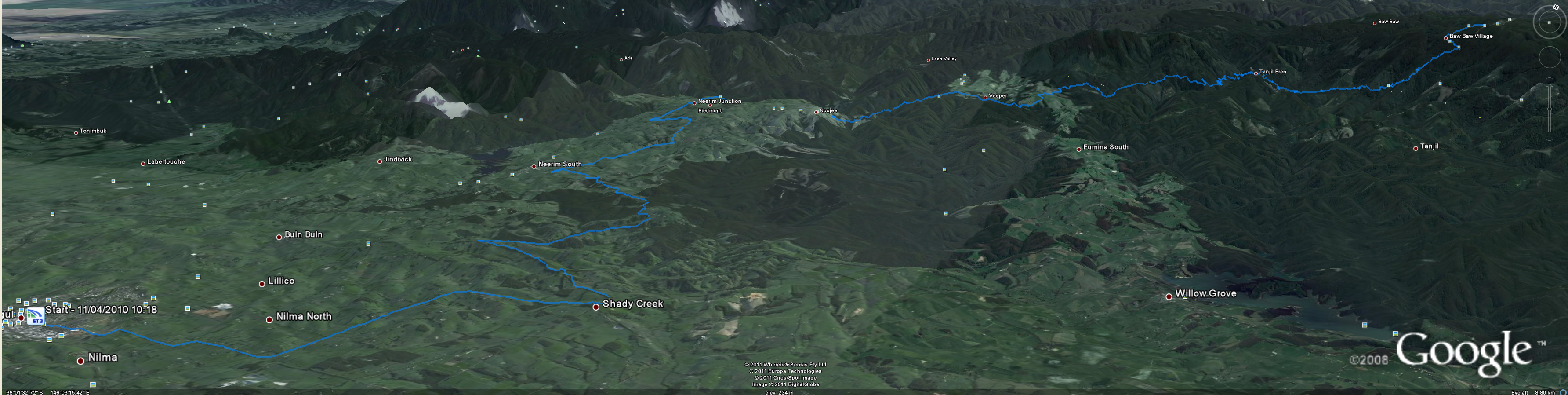
Google View
This race is sure to challenge even the most seasoned racer, with steep descents of -7% and two large climbs with a max gradient of 21%.
Vespers Hill
At the 55km mark, this ascent comes after around 8km of descending and is 4km long at a pretty steady gradient of 8%.
The next 30kms shows a jaggard profile which can be broken into three climbs.
The Final 12km – Almost There
The the final climb begins with 12km to go and averages out at 8%, though the first 6km have an average gradient of 4%.
The Final 6km – The Pain Begins
The final 6km averages at a 13% gradient and peaks at 21%. Some nasty bits of road have good sight lines which can demoralise the tired rider.
With around 500m to go, the course feels like it flattens a little, providing some relief.
Though the climb can be done using a 39×28 gearing without stopping, though a compact or sub compact gearing setup would be kinder on one’s legs.
The weather at the finish can be unpredictable, so riders are advised to carry clothing for all conditions.
Transport from the finish should be arranged prior to the day and spares vehicles operate for the elite groups.

